Mnajdra S, in operation after 5000 years – test of model.

mc5adj2As per picture text (Note: date is correct, but time is not correct). The superimposed picture is a screen-shot from video of the moment of sunrise, taken from within the model. The scale used is a quadrant divided by 90. Adjustment is needed since Spring has 92.8 days. Seasons vary from ~88 to ~94 days.

This unit is still fully functional (but that fact is not known). Yet its workings were the most difficult to unravel, until the method used in Ggantija North unit was perceived. When tested in model form it proved extremely accurate. The test objective was to forecast the solstice day. To date determining solstice day from observation was difficult; forecasting was impossible. The megalithic technique made it simple. (Video here: https://www.youtube.com/watch?v=mIhT65GdjgI  )

Forecasting and knowing the solstice day (winter) is essential in agriculture, to know the time window when the sowing for the coming year’s harvest can be made. Particularly for the cereals, the makers of civilisations. Mediterranean latitudes allow for only one cereal harvest per year, with sowing done after the first rains of Autumn.

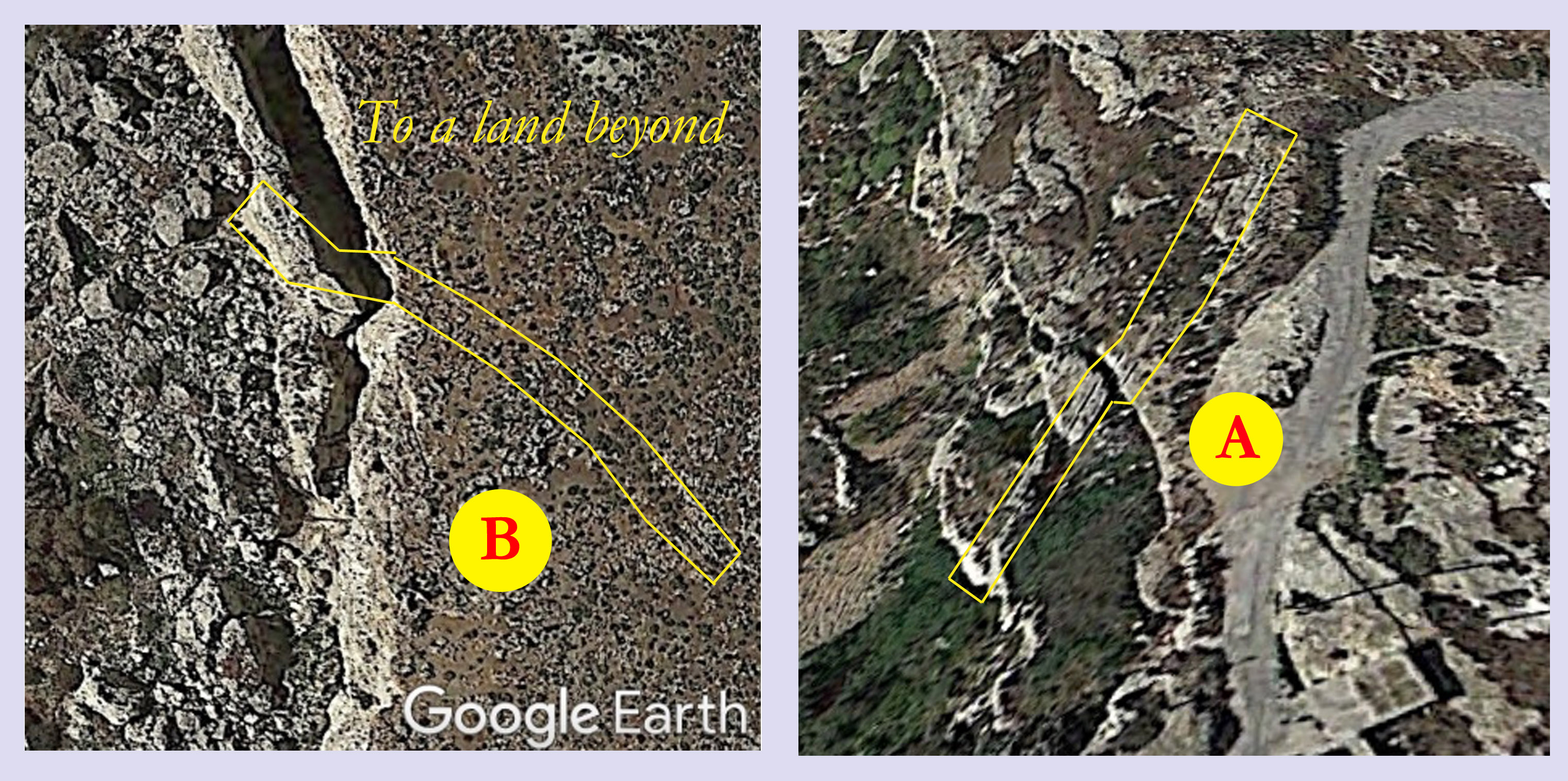
This calendar has another important feature. It was designed on a lower obliquity, same is the other next to it, and several others at different sites, but had to be modified by extending the surface for a change to higher obliquity. The two side stones are the extension.

Tour the site with Google Earth: https://www.google.com/maps/@35.8265491,14.436509,3a,90y,208.24h,78.48t/data=!3m8!1e1!3m6!1s-CxezQUTFEXg%2FVCBgIqDewII%2FAAAAAAAA_u4%2FtryCRoLTDFc9F9uY7Dw5r0clPQ2wWWtpACLIB!2e4!3e11!6s%2F%2Flh6.googleusercontent.com%2F-CxezQUTFEXg%2FVCBgIqDewII%2FAAAAAAAA_u4%2FtryCRoLTDFc9F9uY7Dw5r0clPQ2wWWtpACLIB%2Fw203-h100-k-no-pi-0-ya244.32756-ro0-fo100%2F!7i2508!8i1254

Update July 2023

The above information has now been proven from various other sources. The most descriptive are ancient texts, once the information is gleaned from the mass of accretions, and from many proxies. Even the date of the event of Earth orientation disturbance has been narrowed down practically to the day, give or take a day due to calendar conversion  inaccuracies. The structure in fact proves the ancient texts correct.

Update February 2024

Further material has been unearthed. Confirmation is now strong. Earth dynamic stability disturbance confirmed from ancient textual material (Greek-Plato, biblical texts+Talmud, Hindu ancient texts, Akkadian texts). The modification of the Mnajdra South can be dated very precisely. It is also the initial event that caused civilisation collapse (2346bce – the year of the great famines) and initiated the 4.2k event.

tbc

Featured post

Ancient Mysteries; Hidden Knowledge

An odd subject this. So to introduce the subject first to take a look at the psychology that appears to be behind it.

Dr Amanda Laoupi is an Archaeoenvironmentalist / Disaster Specialist. In one of her papers she presents some specific rules that seem to apply to ancient myths and legends. Two are of major importance and help to understand the past that is evident in many myths and no less in prehistoric remains that may be very difficult to correctly understand. The creation of a myth may reflect on a collective cataclysmic experience and may provide a form of relief. And the myth may conceal a dreadful truth, but at the same time contain enough information for that truth to be unraveled by later generations.

One of the first of the ancient mysteries were megalithic temples that turned out to be ancient solar year calendars. Built over a span of more than two thousand years, the last calendar to be completely built also offered two anomalies. One of these anomalies was evidence of an Earth axial tilt change during its period of use. This became corroborated indirectly in proxies but still it remained an outlier in the ‘established’ field of science. An Earth axial tilt and its effects remained something inconceivable.

Enters Plato. In his work the ‘Timaeus’ Plato starts by explaining an old myth. He says that though it sounds like a myth it is really a declination of the heavens moving around the earth. Such a concept can only arise if the earth itself changes its orientation in space; an axial tilt change. Plato was relating an ancient myth; the Phaethon myth. It relates how the carriage of the sun god Helios was driven astray and caused cataclysmic destruction. Helios’ phaeton appears in the east at sunrise and is always driven west to the sunset. But one day it driven astray and verged to south for a while. An unbelievable tale, except that it is recorded in the modification to the Mnajdra south megalithic calendar.

The consequences of such an event are many and are global. Therefore one is to expect that apart from Plato there were others that created their own myths, based on the same event but with different scenarios. Those myths exist, and were fundamental in providing much detail. They highlight the cause, the dynamics, and the date, – a very precise date -, and the collateral long term events, mainly to agriculture and climate. However it is a long story and this is meant only as an introduction.

To return to the first paragraph, in understanding the megalithic structures, there was left an open question as to why was Mnajdra calendar fully built in all detail when all other of same age were aborted at start of build and abandoned? A message to future generation? One that is hidden in its critical dimensions.

Ref:

Amanda Laoupi “A Primer for Disaster Archaeology”

Amanda Laoupi “GODS IN HEAVEN, HAVOC ON EARTH. ANCIENT GREEK AND SANSKRIT PARALLELS OF COMET / METEOR GODS”

Searching Evidence:  Astronomy for the Heretic

Recent developments in a number of avenues, in both Archaeology and Prehistory, brought about a revisit to one of the earliest anomalies related to the main subject of this site. Fundamentally it concerns one of two major anomalies that were discovered from the Megalithic Temples cum Calendars. It concerns the anomalous values of Earth’s obliquity incorporated in the critical dimensions of the Megalithic Calendar. The latter indicate that during the Holocene, the period in which the calendars were built and used, Earth’s obliquity was different than the values that have been determined from calculations. Obliquity also seemed to have changed repeatedly.

More to the point, this here concerns the values of obliquity that have been measured during the past three millennia, starting with the first recorded measurement of the Chinese from 1100BCE. The series of values, mainly in the first thousand years of measurements, do not correspond, and are somewhat higher than the values calculated in the 1800’s. The matter was first brought to the fore by G F Dodwell in 1936; and later by others. However the design of the megalithic calendar indicates for earlier millennia a much greater variations of Earth’s obliquity.

Plotted on a graph the measured values showed a scatter of points. The interpretations were ‘various’ and for the past several years the matter stood at that. Now in the light of other evidence a different perspective looks realistic. It appears that the scatter of points on the graph is a true indication of erratic movements of obliquity. That matter results from one particular instance that could be and was further investigated. The Chinese record for year 173CE indicates a possible small disturbance of the Earth’s axis; a sharp increase, with a subsequent rapid drop. The measurements were made by the Chinese Liu Hung and Tshai Yung. Two measurements were made in the same year, a high reached by a steep climb and dropping back faster. Repeated measurements five years later found additional drop. It has been noticed that the Earth could be affected by certain planetary alignments. This possibility was also indicated variously in ancient texts, though subject to interpretation.

Year 173CE was an odd spike on the scatter curve. Testing on planetary simulation software, Solar Simulator 2 showed Jupiter Saturn Venus Earth Mars and Uranus were huddled together for a short period of time. However ancient texts also said that events occurred on the night when there was no moon, or similarly, when the sun and moon were together. Checking on a different software, it also indicated the above mentioned planets together for 173CE, and concurrently a moonless night, on the 24th October of that year.

A second corroborating piece of evidence showed up in a paper ( see ref) on glacier ablation fluctuations and lake sedimentation. At around year 173CE there is an abrupt increase in lake sedimentation concurrent with the increase in obliquity. A similar earlier fluctuation is evident for around year 2345BCE, in agreement with both G F Dodwell and the alteration of the Mnajdra megalithic calendar.

Update 8th March 2024: Date 2345BCE narrowed to a more precise 2346BCE. The change in axial tilt causes also an earth precession jump. Ancient Biblical and Hindu texts confirm both jump in tilt and precession, as well as a precise date of the event.

Ref: ” Arctic Holocene glacier fluctuations reconstructed from lake sediments at Mitrahalvøya, Spitsbergen” by W D’Andrea et al. uploaded 2021.

Searching Evidence: Kepler’s Trigons and Events in the Holocene.

This is an updated version of an earlier post to include important additions:

Ancient texts that mention events in prehistoric times, often linked such events of ‘world fire or flood’ with astronomical phenomena. A recent (2005) paper by M. A. van der Sluijs, ‘A Possible Babylonian Precursor to the Theory of Ecpyrōsis’, touches on the astronomical factor in the ancient texts.

A curious piece from the paper is a quote from a Babylonian text, the ‘Babyloniaca’ attributed to the Babylonian priest Berossus (third century BCE), that says, quote: “Berossus … affirms that the whole issue is brought about by the course of the planets”. It refers to the ‘Great Year’, and relates to planetary alignments that were studied by Johannes Kepler and known as Kepler’s Trigon. The major planets are Jupiter and Saturn, and a Great Conjunction is a conjunction of the planets Jupiter and Saturn.

An extract from another Babylonian epic text, one version from said paper reads thus: “– I rose up from my dwelling, and the control of heaven and earth was undone. The very heavens I made to tremble, the positions of the stars of heaven changed, and I did not return them to their places. –” A change in the ‘position of the stars of heaven’ can be a shift in the orientation of the Earth axis. An Obliquity change.

Earlier studies of evidence had provided very near dates to events as they were discerned from the megalithic calendars, together with various proxies that appear to corroborate both dates and events. Searching these dates in ‘Solar System Live’, an on-line software giving planetary positions for specific dates, has resulted in some interesting very near planetary alignment connected to the dates. The dates are too near for simple coincidence. The planets are Saturn and Jupiter, in line with Earth and the Sun, in S J E S order. However such conjunctions are frequent, so the relevance of these specific conjunctions to the prehistoric events remains an enigma.

Update 1: In attached picture, bottom graph, five events corresponding to five consecutive Eddy Cycle roots are indicated. A sixth has since been identified. Circa late 1300bce historically corresponds to the start of the period of civilisation collapse in the Eastern Mediterranean and Aegean.

Update 2: Background: An Earth obliquity change, from a tentative study, can possibly arise if a torque is imposed on the rotating Earth from external sources. Gravitational forces from planetary alignment on an oblate Earth may be such a source. In such a case the gravitational effect of the moon may be a substantial addition, but the software does not indicate the moon’s position. However other sources can provide additional insight.

A recent study of the Biblical Flood as found from the earliest Akkadian sources has provided a clear indicator. The study appears in the book Wasserman, Nathan (2020). The Flood : The Akkadian Sources. A New Edition, Commentary, and a Literary Discussion. Leuven – Paris – Bristol, CT: Peeters.  In a commentary it was said that “The date of the Flood was set at the end of the lunar month, on the darkest night of the month when the moon is invisible.” This important observation indicates that the moon was also in-line with the sun and planets. Other important indicators are also to be found in this study. The ‘Flood’ which is referred to as ‘The Flood from the West’ is found in many flood myth, except as noted, in Egypt. This harks back to Herodotus and his discourses with the Egyptian priests, where it is said ” The sun, however, had within this period of time, on four several occasions, moved from his wonted course, twice rising where he now sets, and twice setting where he now rises. Egypt was in no degree affected by these changes; the productions of the land, and of the river, remained the same; nor was there anything unusual either in the diseases or the deaths.” Two observations here: a movement of the sun’s rising and setting points, which the megalithic calendars clearly indicate in their dimensions. And that Egypt was not effected by a Flood from the West; a geological possibility.

Geology for the Heretic: The Mystery of the Megalithic Calendar Orientations; Resolving site ‘X’.

Mnajdra calendar site consists of three units. The last built at this site is still in its proper orientation, axially aligned to East (and functional). The earlier one in the middle points to SE. The archaic one, ‘X’ in plan, has an enigmatic orientation. It ought to be facing South like several others of similar age, but it is rotated some additional 30 degrees CW. Hence the enigma.

An answer to that enigma is in the geology of the site. It is a coastal site that exhibits signs of it having collapsed. The geology of the land indicates ‘scarp’ faulting where the ground appears to have separated and slid downwards in excess of 100 metres. Beyond the site faulting continues, but now the land is submerged. Here at the water’s edge scarp faulting is very evident.

The major question is one of chronology. It would seem that when the geological faulting and eventual collapse occurred, the early archaic form calendar was already there. The  collapse of the site added to the CW rotation, making the orientation of that early calendar something of an anomaly. The queer orientation may appear to negate the idea of tectonic rotations, but in fact it adds additional evidence, as it provides proof of the cataclysmic nature of the events. The date: ~5200 BCE.

mn sm res5

mnaj1

Geology for the Heretic: The Mystery of the Megalithic Calendar Orientations.

The Megalithic calendars of the Maltese islands needed to be axially aligned to the Equinox sunrise point on the horizon for proper functioning. Yet these are to be found predominantly oriented in three separate directions. The oldest are today facing south, the later ones to south east, and the last built still maintain proper alignment to East. There are a couple of outlier orientations, but these also have an explanation.

The above presented a major anomaly in resolving the functions of the structures. How could such structures change their orientation with respect to the sunrise point on the horizon? While the geology of the Maltese islands indicates unmistakably major events of a cataclysmic nature, it gives little hint as to what took place, and when.

5k1

Palaeomagnetism (the study of the record of the Earth’s magnetic field in rocks) is providing the first hints. This line of research is not quite new, but some answers are quite recent. One very recent paper “Understanding Palaeomagnetic Rotations in Sicily: Thrust Versus Strike‐Slip Tectonics” by Fabio Speranza et al. (April 2018), says “— paleomagnetic investigation of the western Sicily Maghrebian belt has revealed — that large clockwise rotations up to 140° with respect to the Hyblean‐African — “, and ” — clockwise rotations from Sicily are conversely the result of late orogenic dextral strike‐slip tectonics — “. Earlier in another paper by Dijk and Scheepers (1995): “Neotectonic rotations in the Calabrian Arc; implications for a Pliocene-Recent geodynamic scenario for the Central Mediterranean”, say ” — it is crucial to establish the precise timing and location of tectonic rotations”. The authors say ” — tectonic rotation is envisaged by some authors as being a gradual process, whereas others regard it as a sudden event — “. The Megalithic calendars provide one clear instance; and an answer.

New research, particularly in Geology, is clearing the mists around prehistory.

Beyond the Heretic: Reality

The south west coast of the island of Malta is bounded by a major geological fault, known as the Maghlaq Fault. The vertical cliffs here which rise some 180 m above sea level offer some of the best coastline views. They also offer one major mystery.

crt1

The island of Malta is criss-crossed by shallow to quite deep ancient cart-ruts. Next to nothing is known about their age. Speculation apart, there have been studies made in an attempt to find answers. Yet one aspect of a particular few of the cart-ruts runs into a second mystery. Why do they terminate at cliff edges, in mid-air? What geological theory explains them? Where did they lead to? A couple of these cart-ruts are well known, but there are more that are not so evident. Then again, there are ruts that end in mid-air that are inland, at cliff edge over valleys, and others at cliff edge at the coast. However, while these cart-ruts present their own mystery, it is the geological events that left them as they are today that are the more mysterious.

IMG_5861a

The geological mystery of Malta’s cart-ruts is shared by the island’s megalithic calendars. The Megalithic calendars of the Maltese islands needed to be axially aligned to the equinox sunrise point on the horizon for proper functioning. Yet these are to be found predominantly oriented in three separate directions. The oldest are today facing south, the later ones to south east, and the last built still maintain proper alignment to East. There are a couple of outlier orientations, but these still have an explanation. The above presented a major anomaly in resolving the calendars’ functions. How could such structures change their axial orientation with respect to the equinox sunrise on the horizon?

ct b

While the geology of the Maltese islands indicates unmistakably major events of a cataclysmic nature, these give little hint as to what took place, and when. What is definitely obvious is that the geologic events are evident from man-made artefacts. Those artefacts point to the kind of event, and the time when it occurred. In geological time they are quite recent.

The span of time during which the megalithic calendars were built is known to some extent. From proxies coming from various avenues of research the dating for the tectonic rotations is indicated with some reliability. Both tectonic rotations and cart-rut terminations appear as the result of common global events. Thus the geology of the Mediterranean has altered quite recently.

wh4b

See also https://melitamegalithic.wordpress.com/2019/02/03/searching-evidence-5-tectonic-rotations/

Searching Evidence: Deaths, Tsunamis and Earth Dynamics.

Pre-history may sometimes be pieced together like a jig-saw puzzle. But the individual pieces may seem invisible, yet be right under the nose. This post links three contrasting pieces together.

Starting here with the paper from Cain et al “Prehistoric Coastal Mass Burials: Did Death Come in Waves?”, the subject refers to mass deaths, that from evidence, were the result of major tsunamis. The subject was introduced earlier here: https://melitamegalithic.wordpress.com/2018/08/12/searching-evidence-4-prehistoric-mass-burials/

One particular case in the Cain paper is ‘mass burials in relatively tectonic inactive areas’. One is the Storegga slide, dated to 8150BP (6200bce). The other is referred to as the Garth tsunami dated to 5500BP (3550bce). Evidence of the former is extensive, and said to be, quote “Geological evidence can be traced from Norway to Greenland, western Scotland, NE England and Denmark”.

This is where the jig-saw pieces fit in place. While the 6200bce event is well know, it is the 3550bce event that is very telling since it coincides with other evidence that reveals the prime causation. That evidence comes from one particular megalithic calendar site.

The site is Ggantija in Gozo, Maltese islands. Calendar sites are common in the islands but this site is the only one where two calendars have the same axial orientation to equinox sunrise on the horizon. While the older unit was built and subsequently underwent design modification, with a constant ~23deg equinox to solstice angle (VA), the other later one was built to an improved design, but to a reduced angle of ~18deg. That particular angle depends on Earth axial tilt or obliquity, and a change in its value indicates a major dynamic Earth event. That change therefore indicates that both tsunamis and slides could be the result of fundamental and far-reaching events.

ggb1 copy

Proxies correlate chronologically and indicate the events as spikes, abrupt and of short duration. The 6200bce Storegga event was a similar to the 3550bce event, but there is yet no telling and corroborating evidence. Another similar event occurred in 2345bce, however in this case later historical science helped. Such was first deduced by G F Dodwell in 1936, working from ancient measurements of Earth axial tilt. The Mnajdra calendar, a unique case also, records such an event in a later alteration, from an 18deg angle to 29deg.

Such events would be global in effect. The number of mass burials, from diverse places, are possibly evidence of such. That the dates now obtained from widely varied sources correlate, adds further support.

For calendar function, the later design, see https://melitamegalithic.wordpress.com/2017/04/17/melitamegalithic/

Ask Otzi

Sometimes someone comes back from the dead to haunt you. This time it is ‘Otzi the Ice-man’.

The internet site, Malaga Bay, started it off with a post on the Mendenhall Glacier in Alaska. The retreating glacier had uncovered an ancient forest where tree stumps were still to be found in the original position where they once flourished. Wiki gave two particular dates for the trees, about 400 BCE, and ~650 CE. Interestingly both dates correspond to near roots of the enigmatic Eddy cycle. Both dates are from a somewhat little known periods.

From another perspective, Alaska, -and Siberia-, are sites where well preserved mammal remains have, and still are, being found, that raise questions on how they perished. The ‘Ice-age mammals of the Yukon’ show the wide variety of fauna and flora. They were preserved by a ‘fast freeze’ at a time when the climate of the locality then appears to have been warmer than today, as evident by the flora and fauna that the melting ice is uncovering. The interest at this site is mainly on the dating. Dates of some of the Yukon  specimens are placed to the previous ice age period. The Mendenhall trees date to very interesting period post the Holocene Max.

Then came Otzi the Ice-man. Trawling for info came up with this paper. “Radiocarbon dating of the Iceman Ötzi with accelerator mass spectrometry” by Walter Kutschera. This paper came up with a date bang on to a very interesting time. According to the paper and relevant to the vegetative growth in the find place, “Since they apparently grew also at 3210 m (the Ötzi finding place) indicates that a warmer period than today may have existed at the respective time period.”. Possibly therefore it was below the permanent ice line at the time. Which raises the question: what is the ‘fast freeze’ attributed to?

There is a possible answer; one that has showed up elsewhere too. Of the range of dates that appear in the paper one date sticks out; 3230 – 3100 BCE. That date can be narrowed to 3195BCE from tree-rings, or possible 3202BCE based on the Kepler Trigon and Eddy cycle correlation (https://melitamegalithic.wordpress.com/2019/06/02/searching-evidence-keplers-trigons-and-events-in-the-holocene/ )

This is where Otzi the Ice-man comes to life. Did he happen to witness an Earth upheaval that was also fatal to him? Tectonic upheaval in the Mediterranean at that date is evident in the rotation of the megalithic calendars. That same date is marked in research in North Atlantic Ice rafting. The location of the Otzi find ended under ice for the past 5000 years. How? Was it a tectonic uplift to a new elevation rather than just temperature change? Ice core data from the poles indicate that ‘temperature anomaly’ was even higher by 2200 BCE.

Update 1 (Dec 2020):     New data has appeared recently here https://www.nature.com/articles/s41598-020-77518-9.pdf    Two points of concurrence are evident from this new research. In Discussion it is said “the WSS summit location at 3500 m altitude was ice-free during an interval prior to (5.9 ± 0.7) ka.” This agrees with an Earth obliquity change to a lower value at 3550bce/ 5k5y BP, resulting in abruptly colder higher latitudes (but the onset of Sahara desiccation). Then later it is said ” at around 5.3–5.1 ka cal, no ice existed at nearby Tisenjoch, at 3210 m. The fact that the lifetime of the Iceman falls within the maximum age range determined for the WSS summit glacier suggests that a rather rapid neoglaciation ended the formerly near ice-free conditions at the summits in this region.” This agrees with a tectonic event at ~3200bce/ 5k15y BP.  A tectonic event, such as an uplift to higher altitude changes site conditions on a more permanent level. This agrees with the concluding statement. In the conclusion it is said that “Around the lifetime of the Tyrolean Iceman and slightly earlier, rapid ice formation started and some of this ice cover exists to this day.” Which preserved the ice-man to this day without the least body decay.

tbcdelta O2z2

The World of the ‘Two Queens’ – 2

The Myth of the ‘Two Queens’ has an important meaning. The persons of the ‘Divine Triad’, from earliest roots, were mother, daughter, and young son. While this has been evident over the millennia, the meaning of the Triad was not. However there is evidence that its meaning was not lost and appears clear in a painting from Greece. The painting is key to the meaning of the ancient agrarian lore.

It is another representation of the ‘Two Queens’. Painted on a vase, it is a metaphorical representation of the cultivation of the cereals, and at the same time reflects an ancient myth from which it originates, itself a metaphorical lesson in cereal cultivation. The story in the myth represents the life-cycle of the cereal plant, and a calendar of the stages of its cultivation. Hence the link and association to the solar calendar.

ear4

The ‘Two Queens’, now accompanied by the grown child in centre. A plougher par excellence and a ‘seeder of the furrow’, represented as a comparison to human reproduction. His two implements, shown oddly, tell that function clearly. The plough penetrates the earth and in the opened furrow the seed is sown.


The oldest artifact, and most clear in identity because the child is held in a wicker winnowing basket, is of Maltese origin, and is more than 6000 years old. The associated myth in its earliest form and considered of a contemporary age, comes from later texts from ancient Mesopotamia.
The common and central element in the picture is the ‘Ear of Corn’ (added in 1 and 2).

The Child is born in a grain winnowing basket of wicker construction (fig1), the ancient ‘vannus’. As a youth his duties are allotted to him, fig 2. The coming of age as a grown up lad, his work is the ploughing of the furrow and sowing of seed grain, fig3. However in the more ancient myth he represents the ‘vigor and fertility’ of nature. It is an allegory, a personification of grain cultivation.

Blog at WordPress.com.

Up ↑